FORCLIME
Forests and Climate Change ProgrammeTechnical Cooperation (TC Module)
![]()
Select your language


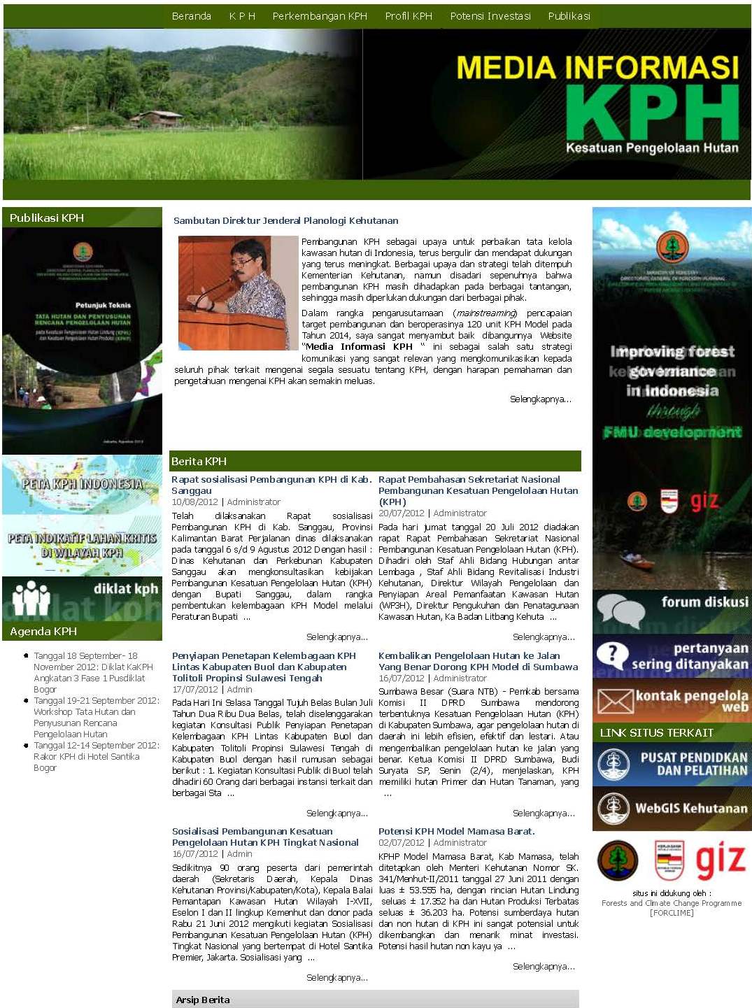
On the occasion of the annual national FMU Coordination Meeting held from 12-14 September in Bogor which gathered all FMU Managers in Indonesia, the Ministry of Forestry through the Directorate General of Forestry Planning launched the FMU Info and Media Center Website which had been set up with support of the FORCLIME Programme. The website, named Media Informasi KPH, can be accessed at: www.kph.dephut.go.id. In his opening speech, the Director General of Forestry Planning, Ir. Bambang Soepijanto, emphasized the importance of the Forest Management Unit as a solution to forest management organization at the site level. He expressed his hope that the FMU will not only be a structural organisation, but also finance its own operations and, moreover, can provide benefits to the region.
The FMU Info and Media Center website provides a wealth of information about FMU development in Indonesia including facts about the current status of FMU development, relevant regulations, guidance documents, good practice examples of FMUs’ operational aspects and FMU profiles. It is expected to be used as a reference by local governments in the process of establishing FMUs and by FMU Managers themselves involved in organisational development, management planning and operation. Moreover, the website provides useful information generally for stakeholders interested in FMU development, such as officials of the Ministry of Forestry and other government agencies, consultants and other service providers, donors, NGOs, etc.
The website is managed by the Directorate of Area Management and Preparation of Forest Area Utilization (WP3H) of the Directorate General of Forestry Planning. It will be regularly updated and enriched with the latest guidance and lessons learned so as to also foster exchange of experiences among FMUs, following the spirit of the annual coordination meetings.
For further information, please contact:
Barbara Lang (barbara.lang@giz.de) or
Gatot Moeryanto (gatot.moeryanto@giz.de) or
Yenny Syafrina (yenny@dephut.go.id)
On 26 July 2012, the Center for Standardization and Environment of the Ministry of Forestry conducted a workshop in Jakarta on the Development of the REDD+ Safeguards Information System in accordance with the decisions of- COP-17. About 100 participants from central and local government agencies, NGOs and related organizations, universities, research institutions, private and international partners attended the workshop.
The Safeguards Information System is a general guidance for the implementation of REDD+ and customized to national conditions and capabilities of each country. Guiding principles for the implementation of the safeguards are transparency, consistency, comprehensiveness and effectiveness. Further evaluation of the implementation of safeguards will be discussed at an international forum.
The Ministry of Forestry through the Center for Standardization and the Environment in collaboration with the GIZ-FORCLIME
Read more: FORCLIME supports the development of REDD+ Safeguards Information System
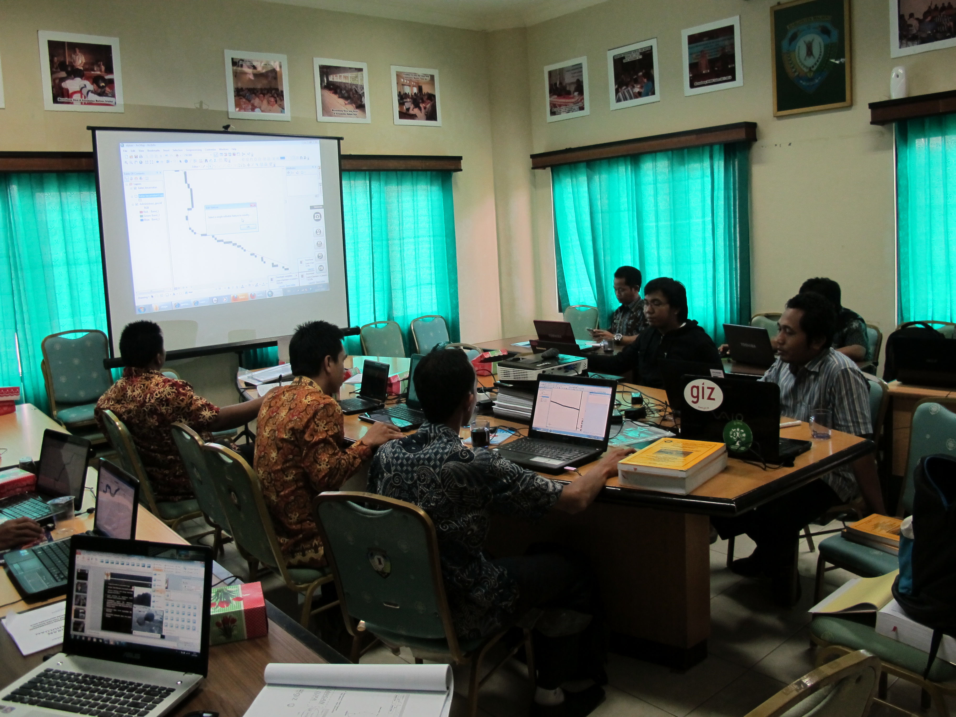
Trainers of GIZ FORCLIME, WWF and the District Planning Agency of Malinau jointly conducted a Basic GIS training from 11th to 18th July for technical staff of the local government. The participants will use their newly acquired skills for surveys in the district and support to environmental monitoring. The training was led by Budi Susanto (GIZ-FORCLIME) and supported by Febriyanto Kolanus (WWF), Timo Beiermann (GIZ-FORCLIME) and Risman (Bappeda) . Participants got familiarized with the new ArcGIS 10 software and had the opportunity of learning new methods for fast and systematic data editing. The training also comprised GPS handling, georeferencing of analogue maps and creating layouts.
The training allowed participants from environmental agencies, the forestry, mining and plantation sectors skills teached included GPS handling, the whole infrastructure of Malinau City was subject of keen investigators. Further georeferecing of analogue maps, generating and editing and finally create a layout of some results. Plan is to proceed with further advanced trainings and expert meetings to subject of spatial data and thematic mapping, e.g. for finding solution for reference problems caused by different standards of Ministries/ Surveyors which lead to conflicts in case of concession holders and protected forest areas or finalising update of rivernetwork which is critical also for customary land boundaries and is always getting a little bit lost in day-to-day business. I had the chance to discuss with Environmental Agency responsible about Environmental and Social Impact Assessment (Amdal) about spatial data for environmental modelling and information about customary land use after having a look in an example.
For more information, please contact:
Timo Beiermann or Budi Susanto
 |
Supported By: |
 |