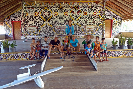
FORCLIME collaborates with Perkumpulan SAMPAN, a local NGO based in Pontianak West Kalimantan, to carry out mapping of the Village Forest area of Setulang in Malinau District, North Kalimantan. Aerial mapping technology, better known as drones, was applied for mapping the working area of the Village Forest of Setulang. It took ten days in January-February 2016 to undertake the mapping using the tarot coopter ironman drone models 680 and fixed wing aircraft SIAR skywalker 1900 series. In addition to mapping of the Village Forest area, the drone also shot pictures for a short movie on Setulang village to promote it as a tourism village. The mapping and movie making activities were conducted in a participatory way, involving both Setulang community members and Village Forest managers.
Findings of the mapping process confirmed very dense forest cover within the Setulang area. It can therefore be assumed that the Setulang Village Forest is still rich with high biodiversity.
For further information, please contact:
Ali Mustofa, Technical Adviser, Community Based Forest Management