“The training materials used were highly relevant and in accordance with working needs within the forestry sector. Moreover, the presenters were all experts in their respective fields and were responsive to the training participants," explained Mr. Maichel Franclin Kareth, Member of Staff for Forestry Business Development at the Papua Forestry Service. "We require further training sessions to be organized for the same participants so that our work is sustainable and in line with targets," Mr. Kareth added
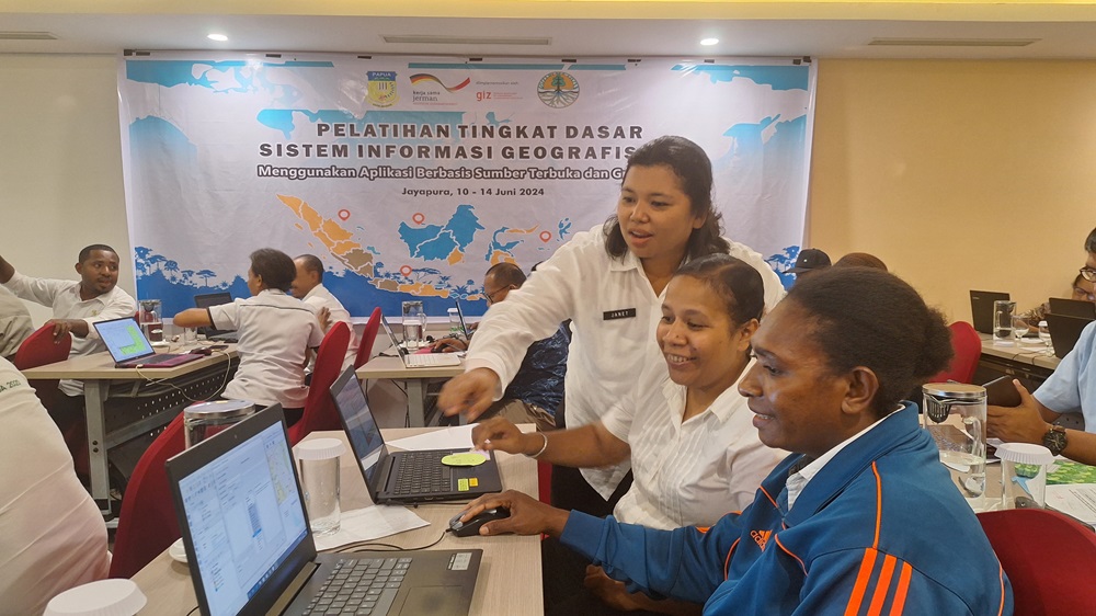
As part of efforts aimed at developing the capacities of Papua Province's forestry-related human resources in relation to Geographic Information Systems (GIS), the Papua Forestry and Environment Service (DKLH), working in conjunction with FORCLIME, recently held a basic level GIS training session for technical forestry personnel under the administration of DKLH. The session was held from 10 – 14 June 2024 in Jayapura, Papua and was attended by 32 participants, 10 of whom were women. In general, this training session aimed to increase the knowledge and skills of forestry-related human resources within the DKLH, including within forest management units (KPH) and DKLH branches, as a part of efforts aimed at supporting forest planning and management activities. The training session utilized free and open source-based applications (QGIS).
During his opening remarks, the Head of the Papua DKLH Forestry Planning Division, Dr. Estiko Tri Wiradyo, said that GIS capabilities were important in terms of the ability to make plans. As a result, DKLH requires staff members who possess adequate GIS-related knowledge and skills.
This training session was facilitated by FORCLIME, while the training instructors comprised two FORCLIME advisors, specifically Danan P. Hadi (Remote Sensing/GIS and eLearning Advisor) and Ruben Yogi (GIS and Mapping Advisor). FORCLIME also utilized the services of Mr. Amadion A. Wanaputra, S.Hut, M.Si., GIS Laboratory Manager at Ottow Geissler Papua University, in order to jointly facilitate the training session. Mr. Wanaputra’s involvement in the training was intended as a first step in terms of introducing the UOGP GIS Laboratory to FORCLIME's working partners.
“The materials provided were easy to understand, while the lessons that were learned during the training session have proved highly useful during our efforts to create a KPH map for Papua Province. I hope that further training sessions will be organized across different levels so that participants will be able to build upon the knowledge that they have already gained,” stated Mrs. Elishe Janet Lusikooy, Forestry Planning Staff Member at DKLH Papua.
This activity will be followed up by coaching and mentoring efforts, particularly for FORCLIME-assisted KPHs, so that they will be able to create maps that will become part of the Long-Term Forest Management Plan document.
For more information, please contact:
Danan P. Hadi, Advisor for Remote Sensing/GIS and eLearning
Ruben Yogi, Junior Advisor for GIS and Mapping
Edy Marbyanto, Strategic Area Manager for Human Capacity Development