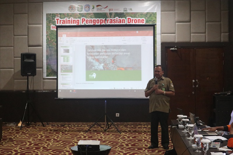
The Ministry of Environment and Forestry (KLHK) through its technical directorates (Forest and Land Fire Control-PKHL; and Inventory and Monitoring of Forest Resources-IPSDH) in collaboration with FORCLIME conducted a training on Operating Drones for Mapping of Forest and Land Fires on 16-17 July 2019 in Pontianak, West Kalimantan. The training, aimed at obtaining more accurate and valid data and was attended by 24 representatives from the West Kalimantan Provincial Forestry Office, DAOPS Manggala Agni, Kubu Raya Forest Management Unit (KPH Kubu Raya) and the KLHK’s technical implementation units in West Kalimantan.
On his remarks, the Director of Forest and Land Fire Control stated that the participants were expected to spread the knowledge and skills acquired during the training to others.
During the training the participants gained knowledge about: (1) How to use drones; (2) Regulations regarding the operation of drones; (3) Validation of hotspots vs burnt areas; (4) Merging of drone data or field data; (5) flight planning; (6) Image processing of burnt areas; and (7) Drone data processing results. On the second day, the participants practiced flying drones and processing data for mapping.
For further information, please contact:
Audita Garry Yuliawan, student intern, Cendrawasih University
Dr. Gamin, Lecturer (Widyaiswara), the Center of Education and Training, KLHK
Gatot Moeryanto, Senior adviser, forest management